
Robotics, driverless vehicles, and computer graphics are just some areas where 3D pointclouds have grown indispensable in recent years. A cloud of points can represent positions in three-dimensional space. Several techniques, including 3D scanning, photogrammetry, and LiDAR, can be used to collect these points. In this piece, we'll define 3D pointclouds, explain how they're made, and go through some of the ways they're used in the business world, emphasising autonomous vehicles.
What is a 3D Pointcloud?
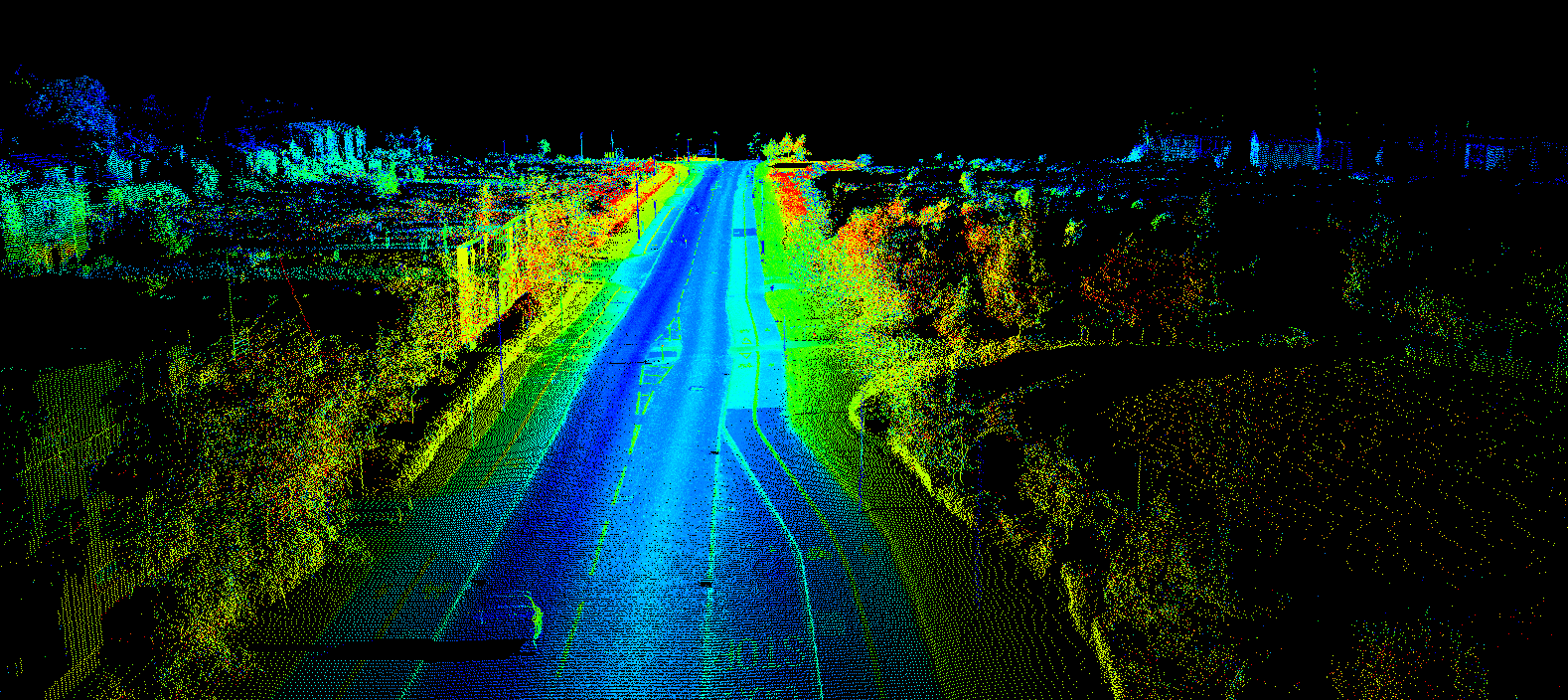
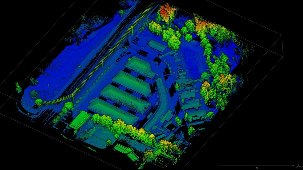
A pointcloud is a three-dimensional representation of an object's surface or features composed of many individual data points. A pointcloud is a collection of points, each of which is represented in space by a set of x, y, and z coordinates. Several methods exist for acquiring pointclouds; these include 3D scanning, photogrammetry, and light detection and ranging (LiDAR).
How is a Pointcloud produced?
Light Detection and Ranging (LiDAR) technology is widely used to create pointclouds. LiDAR devices send laser pulses toward an intended target and measure how long it takes to return to the sensor. The LiDAR system generates a 3D area map by evaluating the time-of-flight data to find the exact distance between the sensor and the object. In addition to LiDARs pointclouds can also be created by RADARs and 3D scanning devices. In all these devices, the underlying technique is similar. They differ however in the resolution and the density of points collected by them.
Why use Pointclouds at all?
While different approaches to acquiring and representing 3D data have limitations, pointclouds have several advantages over traditional scene capturing devices like cameras.
- Pointclouds are accurate and can capture even the finest of details. While camera images provide a scaled down 2D representation of the world, pointclouds provide accurate x,y,z co-ordinates of each identified point on the surrounding objects. This makes them for uses that need extreme precision, such as surveying and mapping.
- Unlike cameras, 3D pointclouds provide a truly 3D view of the surroundings. This means you can see "behind" an object, which is impossible for images produced by cameras.
- Devices producing pointclouds usually work in all weather conditions - fog, snow, rain etc. Cameras can not see through fog, and rain can cloud the lense of a camera, providing an obscured view of the surroundings. This makes them ideal to be used with vehicles, as it provied unmatched safety and redundancy.
Challenges of Using Pointclouds
While pointclouds have several benefits over traditional sensors like cameras, they also presents certain difficulties.
- It is common for pointclouds to accumulate millions of data points, making them challenging to process and interpret. To manage and manipulate the data, specific software and hardware are required.
- Different methods of capturing pointcloud data result in varying quality and accuracy. Lighting and camera settings can impact the accuracy of a photogrammetry survey, whereas the accuracy of a LiDAR scan can be impacted by environmental factors and the surface type being scanned.
- It can sometimes be too expensive for smaller businesses or organizations to acquire the hardware and software to create and process pointclouds.
How is LiDAR Used in Autonomous Driving?
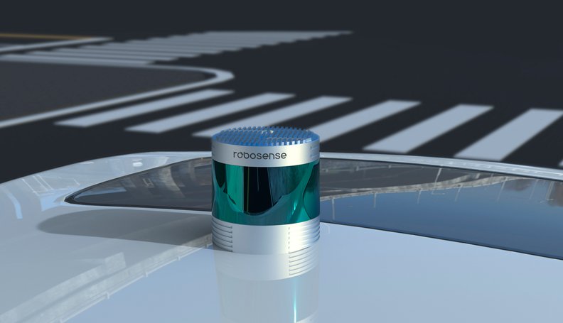
LiDAR technology in autonomous vehicles is one of its most promising fields of application. The vehicle's onboard computer uses the data collected by its LiDAR sensors as part of its 3D maps of the surrounding area and subsequent navigational decisions.
LiDAR sensors combined with multiple cameras are often used by autonomous vehicles to generate a detailed three-dimensional map of their surroundings. The environment is detected through a network of sensors installed on the vehicle's roof, front, and sides.
Not only can autonomous vehicles' LiDAR sensors detect fixed objects, but they can also recognize moving ones, including pedestrians and other vehicles. The computer in the car uses this data to decide where to go and how to get there safely.
Where else in the industry is LiDAR used?
Traditionally, LiDAR has mostly been used in surveying and mapping. In recent years, with the rapid rise of the self-driving industry, LiDARs are being adopted in many other areas as well.
- Civil engineering - LiDAR can be used to make precise three-dimensional models of structures, roads, and other infrastructure for surveying and mapping.
- Agriculture - LiDAR can be used to make comprehensive maps of crop fields and monitor crop health in agriculture. It can also be used to measure the height and density of trees in forest areas.
- Mining - LiDAR can be used to autonomously map mines deep below the earth's surface. This has the potential to save a lot of lives, as it can describe the entire layout of the mine before a human attempts to go in. Since there might not be any light available in the mines, cameras cannot be used in this setting.
- Drone navigation - LiDARs are a popular choice for navigation sensors for drones, as they provide a more accurate and obstacle free view of the surrounding in 3 dimensions.
Pointcloud annotation
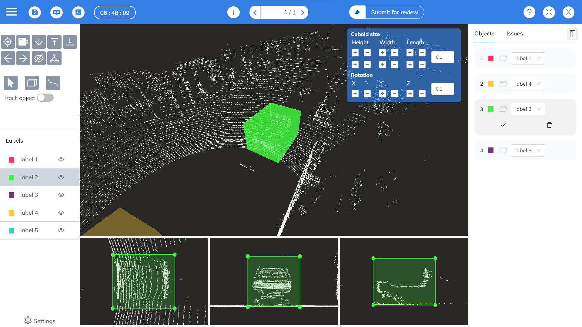
To train Machine Learning algorithms used in autonomous driving scenarios, annotating pointclouds with meaningful information about what the points in the cloud represent is crucial. Without accurate labeled datasets, the system may make incorrect decisions if not given enough context to let it differentiate between various things in the environment.
Annotation of 3D pointclouds is particularly challenging because of the difficulty of identifying and marking objects in a 3D scene. The most critical piece when annotating complex multi-sensor data like LiDAR is the annotation tool. Our own 3D pointcloud annotation tool has been built to support simultaneous annotation of LiDAR as well as any supporting camera images. This allows users to create single objects that can be tracked across sensors as well as across different frames. If you would like to learn more about our platform, just let us know and we will showcase it you!
Conclusion
LiDAR technology is widely used in autonomous driving, surveying, mapping and agriculture as one of the most popular methods for creating pointclouds. The computer in an autonomous vehicle uses data from LiDAR sensors to produce 3D maps of its surroundings and then uses those maps to guide its movement across the area. To train machine learning algorithms used in autonomous driving, however, it is necessary to annotate pointclouds with descriptive information about what the dots in the cloud actually represent.