Polyline annotation is a cornerstone technique in computer vision and machine learning, playing a pivotal role in how machines interpret and understand complex visual data. In this comprehensive guide, we will explore what polyline annotation is, the Machine Learning models that facilitate the detection of polylines in images, and delve into the myriad use-cases where this technology is transforming various industries.
What is Polyline Annotation?
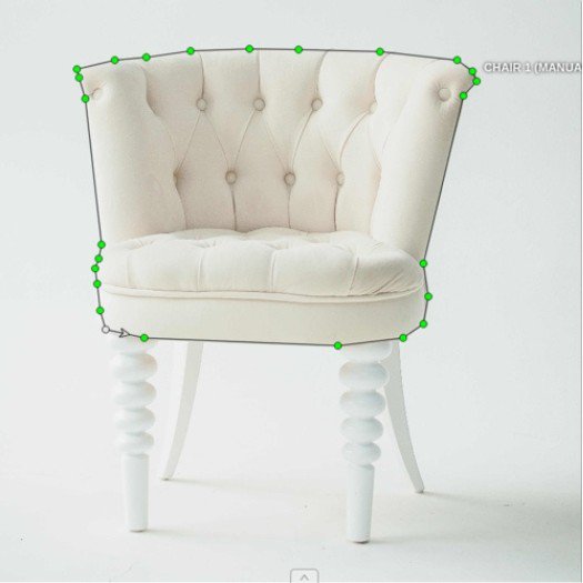
Polyline annotation involves marking a series of connected points to form a line or a set of lines on an image. These annotations outline and identify linear structures within images, such as roads, boundaries, edges, and other elongated features. Each point in the polyline serves as a vertex, and the lines connecting these points capture the shape and position of the feature being annotated.
Key advantages of Polyline annotation include:
- Precision: Allows for accurate representation of linear structures.
- Flexibility: Capable of handling complex shapes and curves.
- Utility: Essential for applications that require detailed mapping and tracing of linear features.
Machine Learning models for detecting polylines in Images
Detecting polylines in images is a complex task that leverages advanced Machine Learning models. Here are some of the key models and techniques used in this domain.
Convolutional Neural Networks (CNNs)
CNNs are widely used for image recognition and processing tasks. They excel at identifying features in images, making them suitable for detecting linear structures. An example model based on CNN is YOLinO: Generic Single Shot Polyline Detection in Real Time
Architectures like YOLO and Mask R-CNN are particularly effective for tasks requiring precise edge detection and segmentation, which are crucial for polyline annotation.
Recurrent Neural Networks (RNNs)
RNNs, particularly Long Short-Term Memory (LSTM) networks, can be used to model sequences and patterns in data. For polyline detection, RNNs can help in understanding the continuity and flow of lines across images.
Generative Adversarial Networks (GANs)
GANs can generate high-quality synthetic data, which can be used to train models for polyline detection. The adversarial training process helps in refining the model's ability to accurately detect and annotate polylines.
GANs can be very useful in scenarios where labeled data is scarce, as they can augment the existing dataset with realistic synthetic samples.
Transformer models
Attention mechanisms, integrated into various neural network architectures, allow models to focus on specific parts of an image when detecting features. This is particularly useful for polyline annotation, where certain areas of an image may contain more relevant information than others.
Transformer models, which utilize attention mechanisms, have shown significant promise in enhancing the accuracy of polyline detection. A recent model called PolyRoad uses transformer models to detect road boundaries.
Polyline detection use cases
Polyline detection has a wide range of applications across various industries, revolutionizing the way we interact with and interpret visual data. Here are some prominent use-cases:
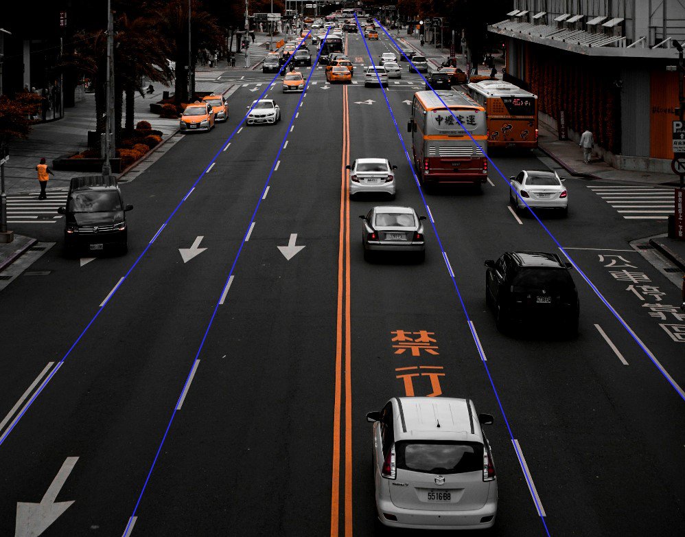
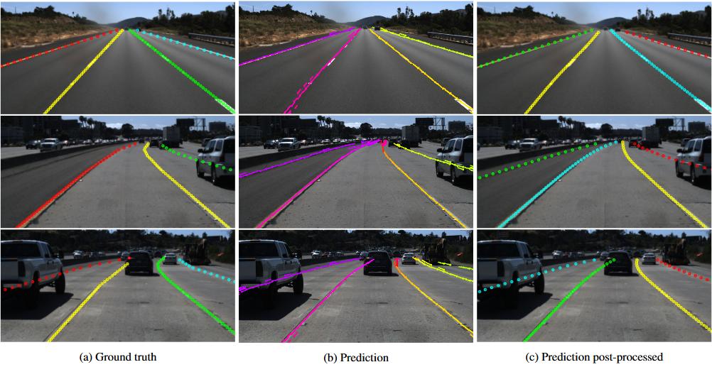
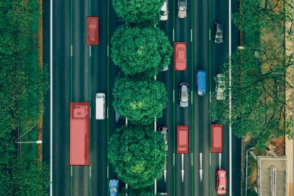
Autonomous Driving
- Lane Detection: Polyline detection is critical for identifying and tracking lanes on roads. This information is essential for the safe navigation of autonomous vehicles, and is the cornerstone of ADAS Level 2 - Assisted Driving.
- Road Mapping: Detailed road maps (HD Maps) which include details like lane markings, boundaries, and traffic signs, enabling autonomous vehicles to make informed decisions.
Geospatial Mapping
- Cartography: Delineate geographical features such as rivers, roads, and borders on maps. This enhances the accuracy and usability of digital maps.
- Satellite Imagery Analysis: Analyzing satellite images to identify and map linear features like pipelines, railways, and utility lines.
Medical Imaging
- Vessel Segmentation: Tracing blood vessels, nerve fibers, and other linear structures within the body through medical imaging. This assists in diagnostics and treatment planning.
- Surgical Planning: Surgeons use annotated medical images to plan and execute precise surgical interventions, particularly in minimally invasive procedures.
Agriculture
- Field Boundary Detection: Identify and map the boundaries of agricultural fields, aiding in efficient land management and crop monitoring.
- Irrigation Planning: Labeled irrigation lines and drainage systems in agricultural fields ensure optimal water distribution and resource management.
Urban Planning
- Infrastructure Development: Map out roads, utility lines, and other infrastructure components in urban planning projects. This ensures that development projects are executed with precision and efficiency.
- Traffic Management: Traffic flow analysis and management benefit from annotated images that highlight road networks, intersections, and pedestrian pathways.
Environmental Monitoring
- Deforestation Tracking: Monitoring deforestation and other environmental changes using satellite images to identify and track changes in linear features like forest boundaries.
- Coastline Erosion: Monitor and analyze changes in coastlines due to erosion, helping in the formulation of mitigation strategies.
Robotics
- Path Planning: In robotics, polylines are used to map out paths and routes for robotic movement, ensuring that robots navigate efficiently and avoid obstacles.
- Object Manipulation: Annotated images help robots in identifying and manipulating objects with precision, particularly in industrial and manufacturing settings.
Challenges in Polyline Annotation
While polyline annotation offers numerous benefits, it also presents several challenges:
Manual Effort
Creating accurate polyline annotations can be labor-intensive and time-consuming, particularly for large datasets. Automated tools and algorithms are continually being developed to alleviate this burden.
Annotation Quality
Ensuring the quality and consistency of annotations is critical. Inaccurate annotations can lead to erroneous model predictions and poor performance in real-world applications.
Complexity of Structures
Annotating complex and irregular structures, such as winding roads or intricate medical features, requires advanced techniques and expertise to achieve high accuracy.
Data Privacy
In applications involving sensitive data, such as medical imaging, maintaining data privacy and compliance with regulations is paramount.
Conclusion
Polyline annotation is a powerful and versatile technique that is transforming how we interact with and interpret visual data across various industries. From Autonomous driving and Geospatial mapping to Medical imaging and urban planning, the applications of polyline annotation are vast and impactful. As Machine Learning models and annotation tools continue to advance, the accuracy, efficiency, and utility of polyline annotation will only grow, opening up new possibilities and driving innovation in countless fields.