Introduction to Lidar
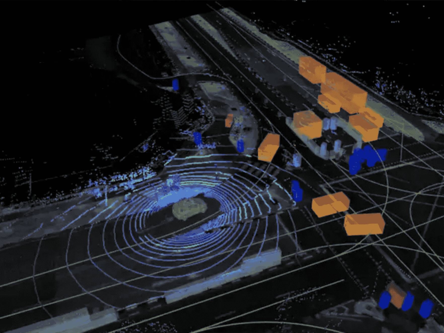
Lidar, an acronym for Light Detection and Ranging, is a remote sensing technology that utilizes laser beams to measure distances and create detailed 3D maps of objects and environments. It emits laser pulses and measures the time it takes for the reflected light to return, calculating distance based on this time-of-flight principle. Lidars can capture millions of data points per second, providing high-resolution, real-time information. Due to its precision, it’s used across numerous industries, from automotive to environmental monitoring.
As Lidar technology has advanced, its applications have expanded significantly due to improvements in sensor accuracy, the reduction in cost, and increased computational power.
Advantages of Lidar
One of the key advantages of Lidar is its high accuracy in measuring distances, even over long ranges. Unlike other technologies such as radar or cameras, Lidar can generate precise 3D maps and detect minute changes in the environment.
Resolution
Lidar produces high-resolution data in the form of point clouds, enabling detailed environmental mapping. This resolution allows Lidars to detect objects as small as a few centimeters.
Range
Lidar sensors offer ong-range detection capability, making them effective for applications that require mapping vast areas or detecting objects at a distance. Some systems can measure distances over several hundred meters with sub-centimeter precision.
Real-time Data
Another critical advantage is its ability to collect real-time data, which is essential for applications like autonomous vehicles, where constant updates are needed for safe navigation.
Weather condition
Moreover, Lidar can function in various lighting conditions, including total darkness, making it superior to visual-based systems in certain scenarios. Lidars also better visibility in foggy and rainy situations, compared to cameras.
Why Lidar is being rapidly adopted
The rapidly increasing adoption of Lidar is due to a combination of high precision, versatility, and falling costs. Lidars can operate in diverse conditions, enabling applications in industries such as transportation, environmental monitoring, and law enforcement.
Improved Accuracy
Lidar provides higher accuracy compared to other remote sensing technologies, especially when combined with real-time data processing systems.
Reduced Costs
Historically, Lidar systems were prohibitively expensive, but recent technological advancements and mass production have significantly lowered the price of Lidar sensors. This affordability has made Lidar accessible for more industries and consumer-level products, including smartphones.
Integration with AI
The integration of Lidar with machine learning and AI systems has further propelled its adoption. This combination allows for intelligent data interpretation, such as recognizing objects in autonomous vehicles or assessing deforestation in environmental studies.
Applications across various industries
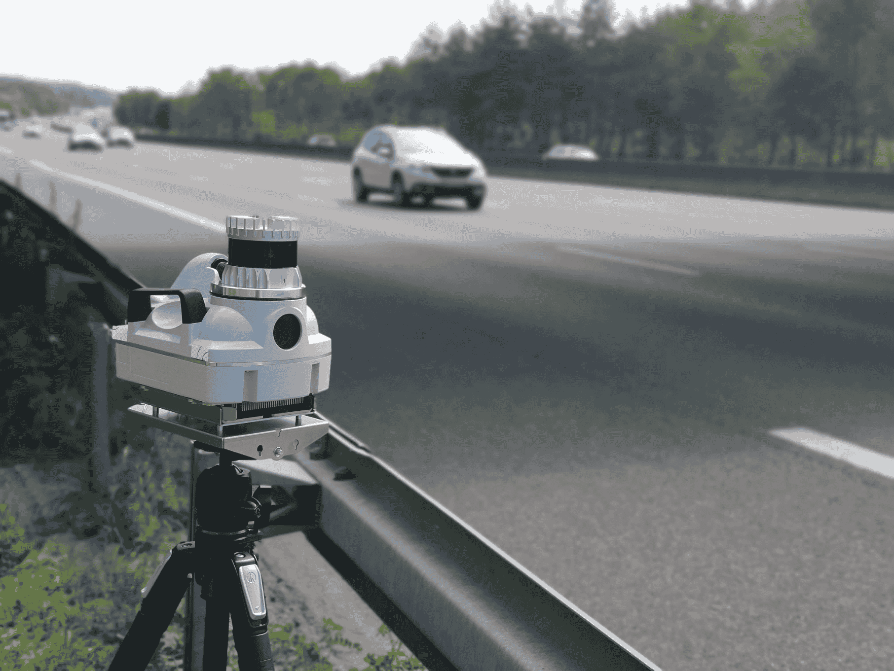
Lidar’s adaptability makes it a valuable tool in numerous industries. Below are some key areas where Lidar is making an impact.
Autonomous Vehicles
Lidar is a fundamental technology in the development of autonomous vehicles. It allows self-driving cars to perceive their surroundings by providing precise, 3D data about the environment. Lidar sensors can detect objects like other vehicles, pedestrians, and road signs in real-time, enabling the vehicle’s AI system to make informed decisions.
- Object Detection and Avoidance: By continuously scanning the environment, Lidar helps autonomous vehicles detect and classify objects, track their movements, and calculate distances. This ensures safe navigation and collision avoidance.
- Mapping: Autonomous vehicles use Lidar to generate detailed maps, ensuring they follow accurate routes and detect road changes.
Construction and Engineering
Lidar is transforming construction and engineering by providing precise data for surveying, mapping, and monitoring large sites.
Site Mapping: Lidar produces high-resolution point clouds that capture every detail of the terrain, structures, and vegetation. These point clouds can be used for land surveying, detecting elevation changes, and mapping infrastructure.
Progress Monitoring: Engineers use Lidar to monitor construction progress by comparing real-time scans with the original project designs. This helps ensure projects stay on track and meet specifications.
Robotics
Robotics relies heavily on Lidar for navigation and obstacle avoidance.
- Autonomous Navigation: Robots equipped with Lidar sensors can navigate complex environments without human intervention. By constantly scanning their surroundings, robots can create real-time maps and avoid obstacles efficiently.
- Industrial Automation: Lidar is also critical in industrial robots used in manufacturing and warehousing, where precise spatial awareness is needed for tasks like picking, packing, and transporting items.
Environmental Monitoring
In environmental science, Lidar plays an essential role in assessing ecosystems and tracking environmental changes.
- Forest Mapping: Lidar is used to measure vegetation density, tree height, and forest biomass. This helps scientists monitor deforestation, assess the health of forests, and study the impact of climate change.
- Land Cover Analysis: Lidar data is used to create detailed maps of land cover, identifying areas undergoing land-use changes such as urbanization or agriculture.
Defense & Military Applications
The military employs Lidar for a variety of tasks due to its precision and real-time capabilities.
- Target Detection: Lidar is used for identifying targets in both military reconnaissance and combat operations. It provides high-resolution 3D maps that are crucial in complex and hostile environments.
- Mapping & Surveillance: Lidar’s ability to generate detailed maps in challenging terrains makes it valuable for military operations, including surveillance and mission planning.
Law Enforcement and Security
Lidar is a valuable tool for law enforcement agencies, particularly in traffic monitoring.
- Speed Enforcement: Lidar guns are used by traffic police to accurately measure vehicle speeds and identify speed violators.
- Traffic Monitoring: Beyond speed detection, Lidar can capture detailed traffic data, which helps authorities manage congestion and enforce road safety.
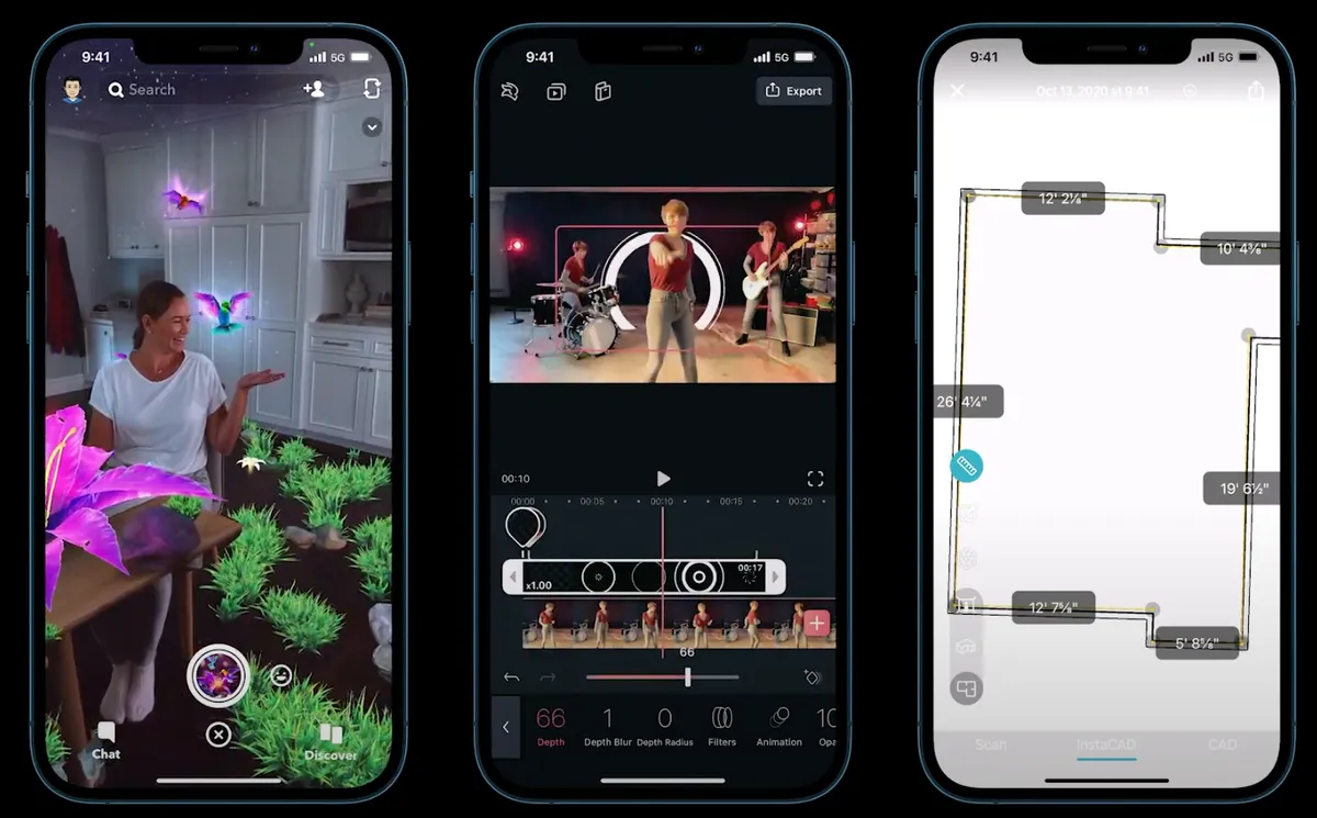
Use of Lidar in iPhones
Apple’s integration of Lidar technology into iPhones showcases its potential in consumer electronics.
- Augmented Reality (AR): Lidar enhances AR experiences by providing accurate depth information, allowing virtual objects to interact with real-world environments more realistically.
- Photography: In photography, Lidar enables faster autofocus in low-light conditions and improves portrait mode accuracy by better detecting edges and depth of field.
Urban Planning and Infrastructure Management
Lidar is transforming urban planning by offering precise mapping and spatial data.
- City Mapping: Lidar aids in the detailed mapping of urban areas, including buildings, roads, and utilities. This helps city planners design better infrastructure and manage utilities more efficiently.
- Hazard Detection: By analyzing Lidar data, city planners can identify potential hazards, such as weak infrastructure or areas prone to flooding.
Archaeology and Cultural Heritage
Lidar provides archaeologists with a non-invasive way to explore historical sites.
- Site Mapping: It helps archaeologists create high-resolution digital elevation models of landscapes, revealing hidden structures like ancient roads, buildings, or entire lost cities buried under vegetation.
- Artifact Preservation: Lidar enables precise mapping without disturbing the ground, preserving cultural heritage sites for future study.
Conclusion
Lidar’s wide range of applications across industries—from autonomous vehicles to archaeology—demonstrates its versatility and potential. As technology advances and costs continue to fall, the future promises even broader adoption of Lidar, unlocking new possibilities for innovation and growth.


