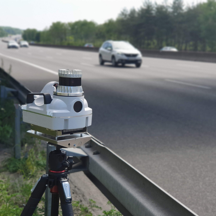
LiDAR, or Light Detection and Ranging, is a cutting-edge remote sensing technology that uses laser light to measure distances. It has become an essential tool in various fields, from autonomous vehicles to environmental mapping. Understanding the range of LiDAR sensors is critical for optimizing their performance in different applications. The detection range depends on multiple factors, including sensor specifications, environmental conditions, and technological aspects.
This comprehensive guide delves into the factors influencing how far a LiDAR sensor can detect and compares LiDAR’s capabilities with other technologies like radar.

Factors Influencing LiDAR Detection Range
LiDAR Sensor Specifications
The technical specifications of a LiDAR sensor are a primary determinant of its detection range. Several key elements play a role:
- Power Output: A higher-power laser can detect objects at greater distances because more light is reflected from the target.
- Wavelength: LiDAR systems commonly use infrared or visible light wavelengths. Infrared sensors generally perform better in certain environmental conditions, such as through smoke or dust.
- Sensor Sensitivity: The ability of the LiDAR receiver to detect the reflected signal is crucial. More sensitive sensors can detect weaker signals from objects at greater distances, improving the overall range.
A LiDAR system with enhanced power, a suitable wavelength for the application, and high sensitivity will naturally have a longer detection range.
Atmospheric Conditions
Atmospheric conditions can significantly impact the effective range of a LiDAR sensor. Factors like fog, rain, snow, or even dust particles in the air can scatter or absorb the laser beam, reducing its ability to reach the target and reflect back to the sensor. For instance:
- Fog and rain introduce moisture that scatters the laser pulses, limiting the system's range.
- Dust or smoke can absorb or deflect the laser light, reducing detection distances.
Therefore, applications in adverse weather conditions require LiDAR systems designed to minimize signal loss due to atmospheric interference.
Object Reflectivity
The material and surface of the object being detected also influence the LiDAR range. Reflectivity refers to how much of the laser light bounces back to the sensor after hitting an object.
- Highly reflective surfaces (e.g., metals, white surfaces) reflect more laser light, allowing the sensor to detect them from further away.
- Non-reflective surfaces (e.g., dark objects, matte finishes) absorb much of the light, reducing the maximum detection distance.
Optimizing a LiDAR system’s performance requires considering the reflectivity of the objects it is expected to detect in specific use cases, such as vehicles or obstacles in autonomous driving.
System Use and Configuration
The configuration and intended use of a LiDAR system also impact its detection range:
- Field of View (FOV): A larger FOV allows the sensor to capture more area at once but may reduce range resolution due to the spread of the laser pulses.
- Angular Resolution: Higher angular resolution improves the precision of object detection but may slightly reduce the system's overall range.
Systems optimized for wide-area mapping often sacrifice angular resolution to maximize the detection range, whereas systems for autonomous vehicles focus on precision over range.
Technological aspects affecting detection range
Time of Flight
LiDAR technology relies on measuring the time it takes for a laser pulse to travel to an object and back—referred to as the time of flight. The speed and accuracy of these measurements influence the maximum distance a LiDAR system can accurately detect. Systems with more precise time-of-flight measurements typically offer longer detection ranges.
- Shorter pulse durations lead to more accurate distance measurements and help in resolving objects at varying distances, which is critical in applications like autonomous driving.
Signal Return and Processing
Advanced signal processing techniques help LiDAR systems extend their range by improving the signal-to-noise ratio. In scenarios where the laser pulse might encounter interference or weak reflections, enhanced processing algorithms can extract meaningful data from noisy returns.
For example, systems equipped with multi-return capabilities can detect objects even when multiple reflections from different surfaces (like foliage or buildings) occur, allowing for clearer, more reliable range detection.
Laser Pulse Characteristics
The characteristics of the laser pulse, including its frequency and pulse duration, play a vital role in determining how far a LiDAR sensor can detect. Higher-frequency pulses typically allow for more detailed scanning at close ranges but may reduce the overall detection range.
- Longer pulses may extend detection range at the expense of resolution, while shorter, more frequent pulses offer higher resolution but might not detect distant objects as effectively.
Comparative analysis with other technologies
LiDAR vs. Radar
While both LiDAR and radar technologies are used for distance measurement, they function quite differently:
- LiDAR: Uses laser light to provide high-resolution, accurate distance measurements but has a shorter range, especially in adverse weather.
- Radar: Uses radio waves, which can detect objects at greater distances and through challenging atmospheric conditions, though with lower resolution.
Radar is often preferred in long-range detection scenarios like aviation, while LiDAR excels in close-to-mid-range applications where precision is critical, such as autonomous vehicle navigation. You can read a more detailed comparison between Lidar and Radar here.
Airborne LiDAR
Airborne LiDAR, commonly used for topographic mapping and environmental monitoring, operates differently from ground-based systems. These systems must cover vast areas from high altitudes, requiring specialized configurations to maintain an effective range.
- Altitude: Higher altitudes necessitate longer detection ranges, which is why airborne systems typically employ more powerful lasers with wider fields of view.
- Wide-area coverage: Airborne LiDAR systems are designed to balance range with resolution, ensuring detailed terrain mapping over large geographic areas.
Applications and Use Cases

Autonomous Vehicles
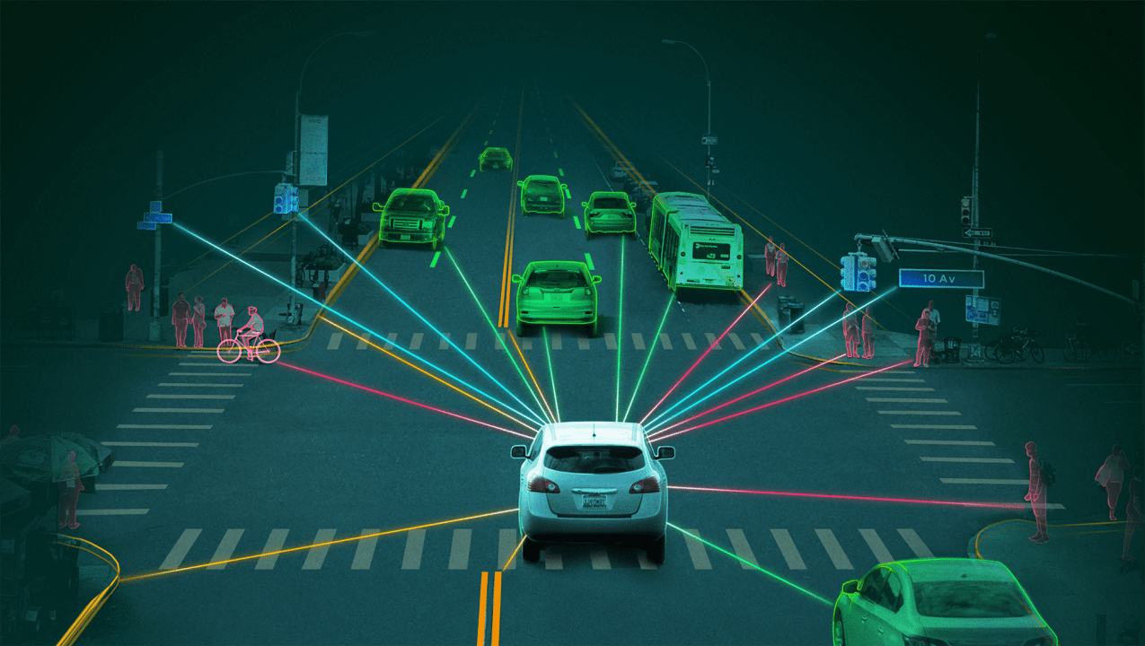
In the autonomous vehicle industry, the detection range of LiDAR is crucial for safety and navigation. Vehicles rely on LiDAR to detect other vehicles, pedestrians, and obstacles, particularly at high speeds where long-range detection becomes vital.
- Longer ranges allow vehicles to detect obstacles well in advance, providing time for safe navigation and avoiding collisions.
- Shorter-range precision helps autonomous systems accurately map the immediate environment for navigation, parking, and close-proximity maneuvers.
Environmental Monitoring
LiDAR is widely used in environmental monitoring applications such as forestry, agriculture, and climate studies. The detection range determines how wide an area can be scanned in a single sweep, making it a critical factor in large-scale mapping efforts.
- Forestry and agriculture: LiDAR is used to create detailed models of terrain, vegetation density, and canopy structure, which are essential for environmental management.
- Atmospheric monitoring: LiDAR systems can be deployed to measure cloud formations, pollutants, and other atmospheric phenomena.
You can read a more detailed analysis of which industries use Lidars here.
Conclusion
The detection range of a LiDAR system is determined by a variety of factors, including sensor power, wavelength, atmospheric conditions, object reflectivity, and system configuration. Technological advancements in signal processing and laser pulse characteristics have continued to push the boundaries of how far LiDAR can detect. Whether in autonomous vehicles, airborne systems, or environmental monitoring, understanding and optimizing these factors is crucial for maximizing LiDAR’s potential across different applications.


