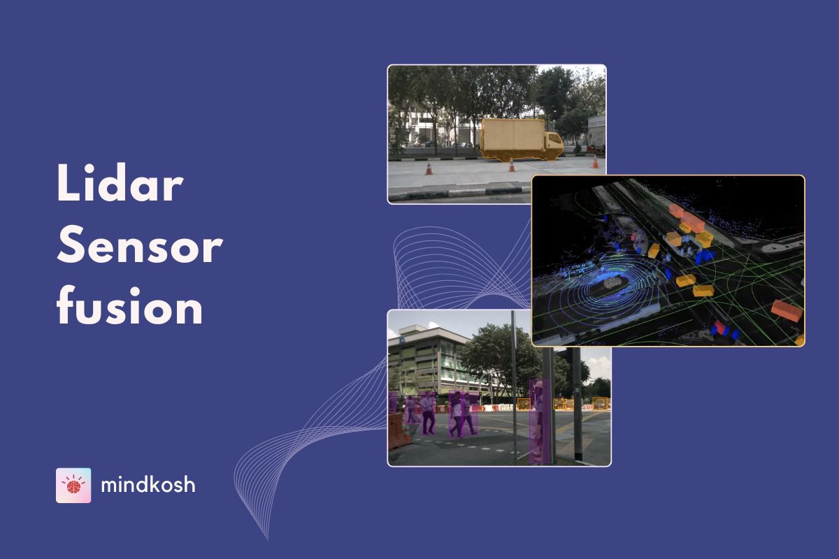
Imagine having the power to see through dense forests, peer beneath thick canopies, and capture the precise shape of the ground beneath your feet. Lidar mapping does that and more ! Lidar mapping uses Lidar sensors to create detailed, highly accurate 3D maps of the environment which can then be used for a variety of downstream applications.
The ability of Lidars to penetrate dense vegetation allows us to map remote, hard-to-reach areas, which was once a time-consuming and nearly impossible task. Thus, Lidar mapping is being rapidly adopted across industries - from urban planning to forestry, and even disaster management. It can be used to monitor forests for illegal logging, design infrastructure projects with pinpoint accuracy, and map terrain changes that help predict natural disasters like floods and landslides.
What is a Lidar sensor?
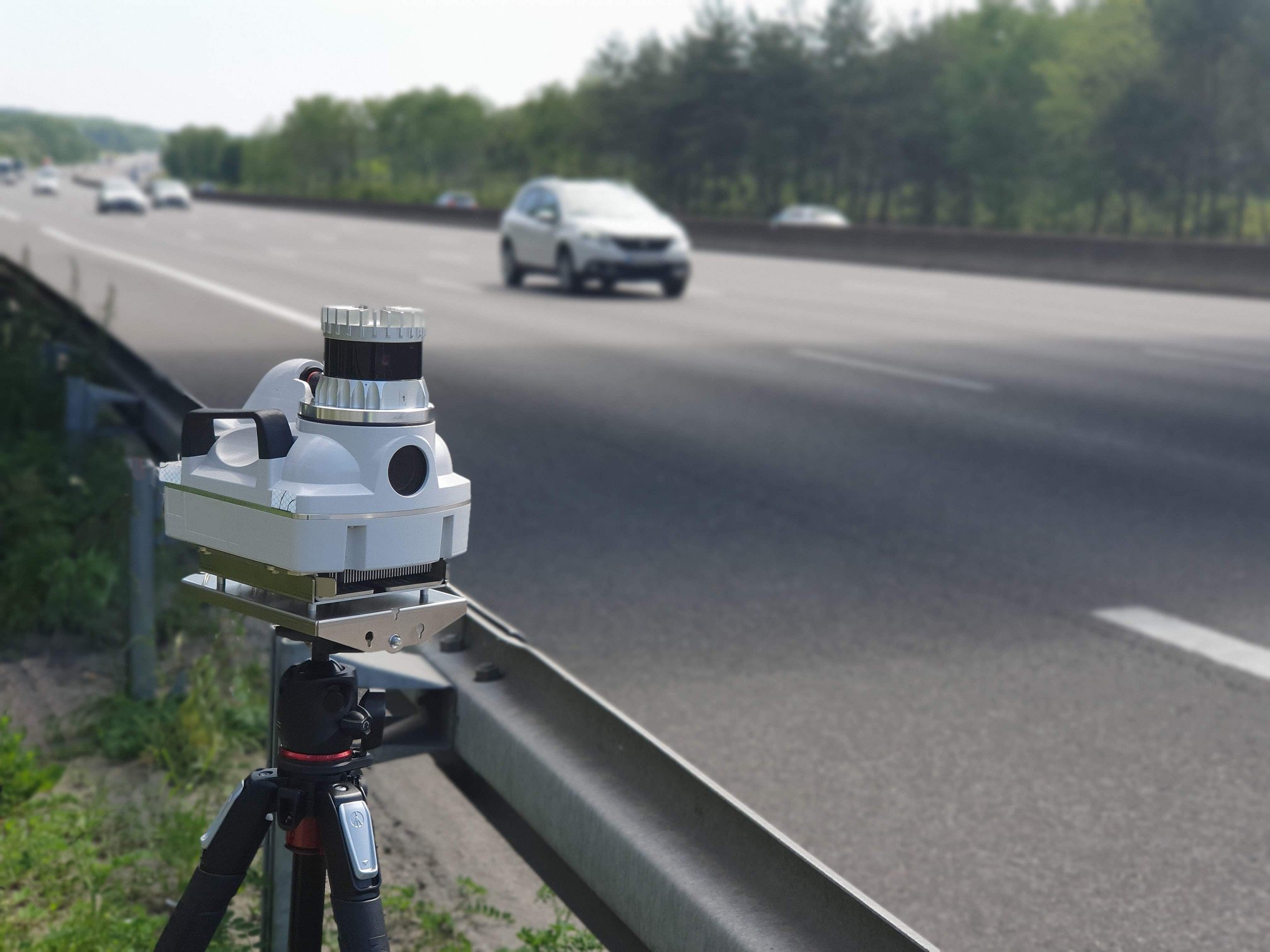
Lidar sensors are specialized devices designed to emit laser pulses and capture the reflected data. These sensors come in a variety of forms—airborne, terrestrial, and mobile—each tailored to specific use cases.
Mounted on drones, planes, or ground vehicles, Lidar sensors capture data from virtually any environment. The flexibility of these sensors allows them to be used in vast landscapes like forests or mountains, as well as in highly detailed urban settings. The real magic, however, lies in their ability to generate dense data sets that represent the surrounding area in three dimensions.
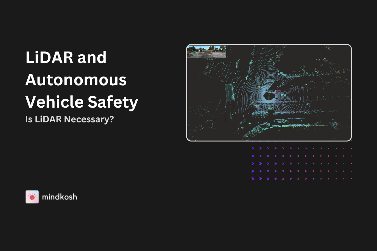
Lidars have found their way into growing number of exciting new applications. For instance, autonomous vehicles rely heavily on Lidar for real-time mapping and navigation. The automotive industry uses it to ensure that self-driving cars “see” and understand their environment. Similarly, it’s used in renewable energy, helping engineers determine the best locations for wind turbines and solar farms.
How Lidar Sensors work in Mapping
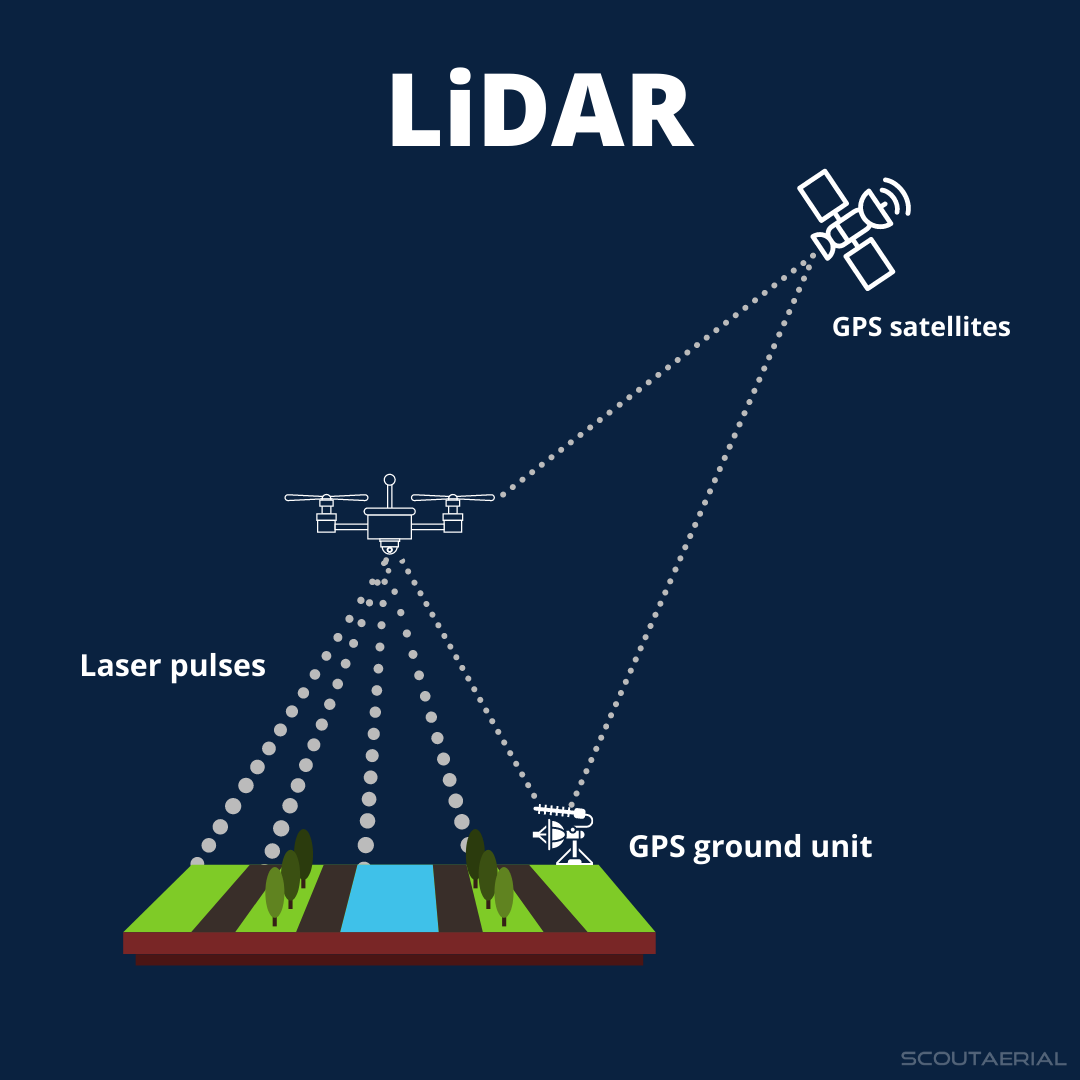
When it comes to mapping, the process is as fascinating as it is technical. Lidar sensors fire laser pulses toward the ground or objects, measuring the time it takes for the light to reflect back. This time-of-flight calculation helps create a precise model of the environment. But Lidar doesn’t just stop at measuring the distance—it records the exact position of millions of laser points, which are then combined into a detailed point cloud.
The sensor doesn’t rely on sunlight, so it works effectively both day and night. This independence from external lighting conditions makes Lidar highly versatile for various applications, whether it’s mapping a dense urban environment or monitoring deforestation in a remote jungle.
Lidar as a Remote Sensing Method
Lidar is a prime example of remote sensing, meaning it collects data from a distance. This is what makes it so powerful; whether you're mapping a mountain range from an aircraft or a building from a drone, Lidar provides detailed and precise results without needing to be in direct contact with the object. It’s used widely in both environmental sciences and civil engineering due to its ability to survey large and complex areas quickly.
Lidar Mapping Process
Data Collection
There are two primary methods for Lidar data collection:
- Airborne Lidar: Mounted on drones or aircraft, this method is perfect for covering large expanses of land. It’s often used in terrain mapping, forest canopy analysis, and flood modeling.
- Ground Survey: Terrestrial Lidar uses sensors mounted on vehicles or tripods. This is ideal for smaller-scale projects that need ultra-high detail, like mapping cityscapes or construction sites.
By using either airborne or terrestrial methods, Lidar delivers flexibility in capturing data depending on the project’s requirements. The airborne approach allows us to scan vast areas, while ground-based surveys offer richer detail in a more focused scope.
Point Cloud Generation
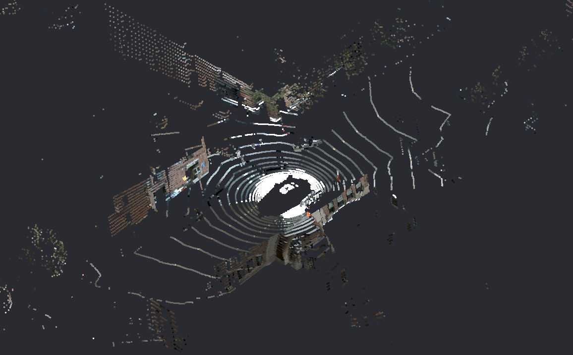
Once the data is collected, the real magic begins with the creation of a lidar point cloud—a collection of millions of data points in 3D space. These points represent every laser pulse emitted by the sensor, and together, they form an incredibly detailed digital map of the environment.
Each point in the cloud corresponds to a specific X, Y, and Z coordinate, marking the precise location of an object or surface. This vast network of points is what allows Lidar to build complex 3D models of everything from mountain ranges to skyscrapers. Engineers and scientists can then use these point clouds to measure distances, calculate volumes, and assess terrain in ways that were previously unimaginable.
Terrain Elevation Mapping
One of the most important applications of Lidar mapping are in the field of terrain elevation mapping. Lidar can penetrate through tree canopies and other vegetation to measure the ground surface below, offering a clear and accurate view of the Earth’s topography. This is crucial for creating Digital Elevation Models (DEMs), which provide a bare-earth representation of the land.
DEMs are valuable in numerous fields, such as flood risk management, infrastructure development, and environmental protection. Whether you're planning a road through mountainous terrain or assessing the risk of landslides, Lidar provides detailed elevation data that traditional surveying methods simply cannot match.
Combining Lidar Maps with Other GIS Layers
By combining Lidar maps with GIS (Geographic Information Systems) layers, we can achieve even more powerful results. For example, Lidar data can be merged with satellite imagery to produce a rich, multi-layered map that reveals both the terrain and its ecological features. This integration enables city planners, environmentalists, and engineers to gain a more comprehensive understanding of an area’s layout and its potential for development.
A Lidar map might give you the shape of the land, while a satellite image adds details like vegetation, buildings, and roads. By layering these data sets, you get a detailed, interactive map that enhances decision-making in everything from urban planning to conservation efforts.
Use Cases for Lidar Mapping
Geospatial Data Collection
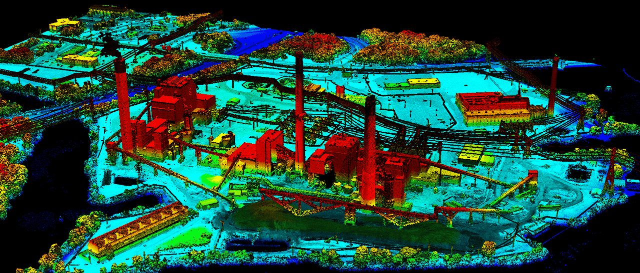
In the world of geospatial data collection, accuracy is everything. Lidar excels at collecting high-resolution, detailed data that forms the basis of accurate maps. Whether it’s for creating topographic maps or monitoring environmental changes, Lidar provides the precision necessary for successful projects. It’s used in everything from land development and disaster preparedness to archaeological excavations.
Aerial Lidar Mapping
Aerial Lidar mapping provides an efficient method to map out large geographical areas. By mounting Lidar sensors on drones or aircraft, vast landscapes can be scanned in a fraction of the time it would take with traditional methods. This makes it indispensable for large-scale projects like coastal mapping, forest management, and flood modeling. Aerial Lidar allows for the swift collection of geospatial data over areas that would otherwise be difficult to access, like mountain ranges or dense forests.
Lidar Mapping in Remote Sensing
Lidars also play a crucial role in remote sensing, especially when combined with other technologies like satellite imaging and radar. This combination allows researchers to create more detailed and comprehensive models of the environment. It’s used to track changes in forests, measure ice sheet thickness, and monitor urban growth.
Lidar is invaluable in environmental monitoring, providing real-time data for assessing the impacts of climate change, deforestation, and natural disasters. With its high-resolution data, Lidar enables scientists and policymakers to make better-informed decisions about land management and resource conservation.
Challenges in Lidar Mapping
While Lidar offers numerous benefits, it does come with its own set of challenges. The primary difficulty lies in the sheer volume of data it generates. Processing, analyzing, and storing this data requires sophisticated software and powerful computing resources. Additionally, Lidar data can sometimes be challenging to interpret, particularly when dealing with reflective surfaces like water, or when there’s interference from dense infrastructure.
Moreover, Lidar systems can be expensive to deploy, especially for smaller projects, limiting its accessibility to organizations with substantial budgets.
Conclusion
Lidar mapping is a groundbreaking tool that is transforming the way we understand and interact with the world around us. From its ability to map complex terrain and dense forests to its role in advancing autonomous technology and remote sensing, Lidar is at the forefront of modern mapping solutions. As the technology evolves, we can expect even more exciting innovations, making Lidar an essential tool in industries ranging from civil engineering to environmental science.
The future of Lidar mapping is bright, and its potential applications are limited only by our imagination. Whether it's unveiling ancient cities lost to time or helping to chart a sustainable future, Lidar will continue to shape the way we explore and understand our world.


